
How to Buy Land for Sale in Colorado: Zoning, Utilities & Due Diligence
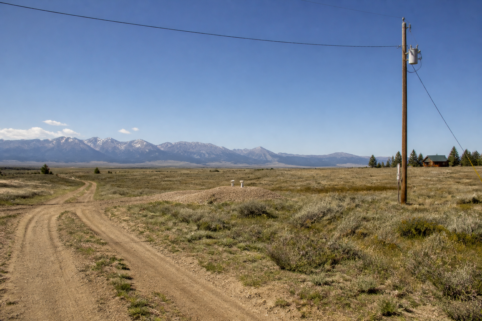
You've found a 35-acre parcel outside Buena Vista listed at $310,000. The septic disclosure is blank, the listing says "water rights conveyed," and the county GIS map shows it as "AG-1." Three weeks later you discover the decree is a junior 1987 right that gets curtailed every drought year, the soil percs at 8 inches per hour (too fast for conventional septic), and AG-1 caps your home footprint at 2,400 sq ft. None of this appeared on the MLS. Before you sign on any land for sale colorado brokers are pitching this season, you need a verification framework — not a checklist of feelings about views and elevation. This guide walks through the six verification gates that separate a Colorado rural land purchase from a financial trap, with exact costs, timelines, and contingency language. The stakes are quantifiable: according to the University of Denver Housing Policy Center, 72% of first-time rural Colorado land buyers underestimate utility costs by $30,000 or more. That gap is not bad luck. It is a missing process.
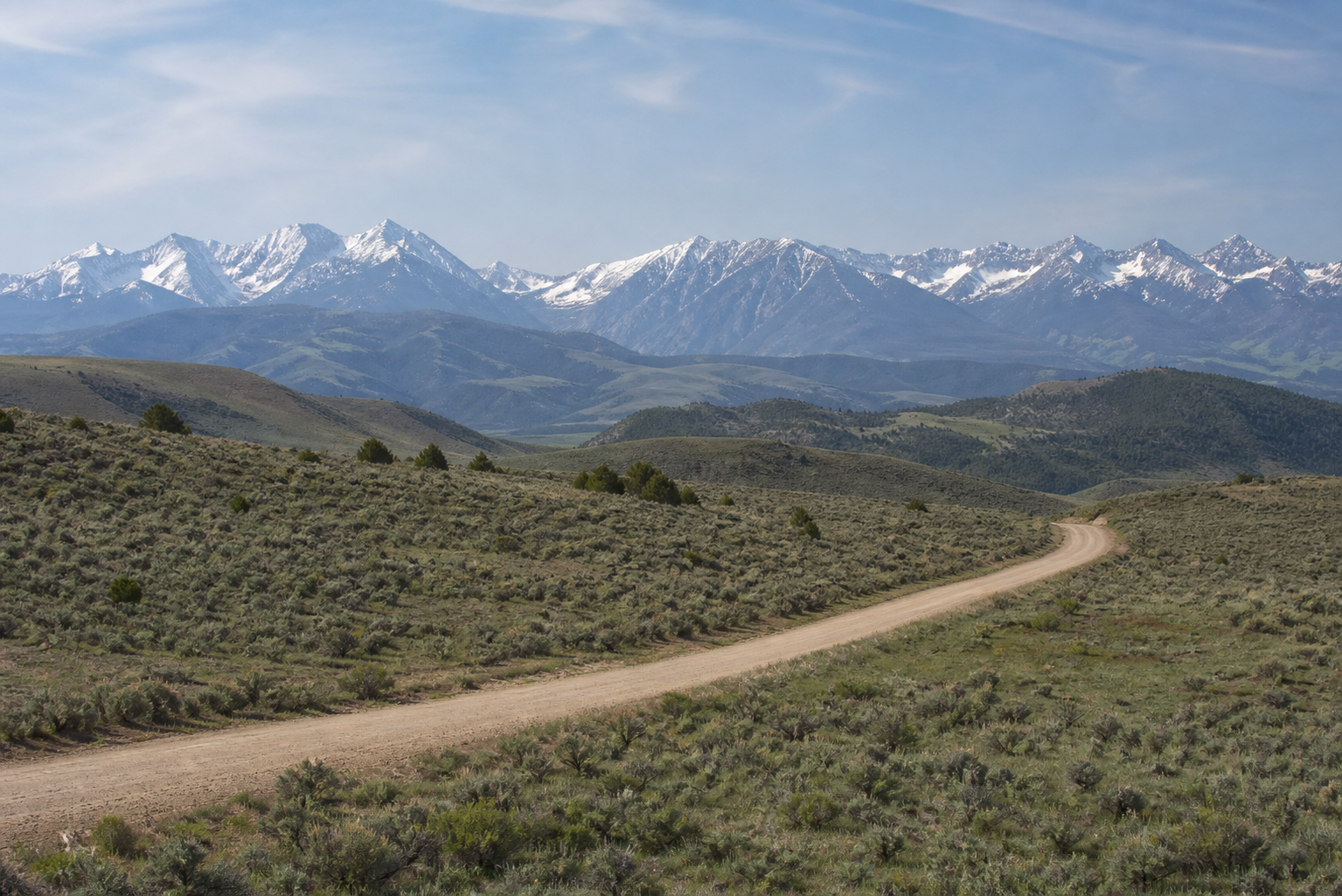
Table of Contents
- Why Zoning Dictates What Your Colorado Parcel Is Actually Worth
- How to Pull Zoning and Land-Use Data Before You Make an Offer
- Water Rights, Septic, and Utilities: The Three Cost Bombs Beneath Every Rural Parcel
- The Six Due-Diligence Inspections That Decide Whether You Close
- Contingency Language That Actually Protects a Land Buyer
- The 45-Day Colorado Land Purchase Workflow: Week-by-Week Verification Map
Why Zoning Dictates What Your Colorado Parcel Is Actually Worth
In Colorado, zoning is not a formality you sort out after closing. It is the contract that determines whether the price-per-acre you are paying makes any financial sense. The state operates under the Dillon Rule, meaning Colorado courts interpret local government authority restrictively — counties and municipalities can only regulate what state statute explicitly permits. The practical effect is the opposite of what most buyers assume: what counties DO regulate (zoning classifications, building standards, on-site wastewater systems), they enforce strictly. A county zoning officer's written interpretation is binding. "We'll figure it out later" is not a strategy; it is the prelude to a stop-work order.
Four zoning realities catch buyers repeatedly:
- Density caps. Agricultural zoning in counties like Park, Custer, and Fremont commonly requires 35-acre minimums per dwelling unit. That means a 40-acre parcel equals one house — not a subdividable investment. The math people run on per-acre prices assumes future flexibility that the code denies.
- Use restrictions. A "Rural Residential" designation allows a single-family home but routinely bans short-term rentals, secondary dwellings (ADUs), and any commercial activity — no contractor yard, no kennel, no wedding venue, no agritourism.
- Setbacks. Rural Colorado setbacks run between 50 and 200 feet from property lines according to the Colorado Department of Local Affairs. On a narrow 5-acre parcel, setbacks of that magnitude can eliminate 60% of the buildable area before you have drawn a single line.
- Non-conforming status. An existing cabin or well may be "grandfathered" under prior code. If it burns down or you substantially alter it, the rebuild must meet current code — which, on certain parcels, makes rebuilding effectively impossible.
Zoning is not something you discover after purchase. It is the contract that tells you what you can actually do with the land you just paid for.
The county overlay is more aggressive than most listings disclose. A Rocky Mountain Land Use Institute review found that the majority of Colorado counties have implemented building caps, RV-living bans, and agricultural preservation covenants that materially limit how parcels can be used. None of those appear on a typical MLS card. They appear in the county Land Use Code, which is a free PDF that almost nobody reads before writing an offer. The same code-first discipline applies whether you're evaluating raw acreage or scanning homes for sale near me — the listing is the marketing; the code is the contract.
Now map zoning onto price. According to the Colorado State University Agricultural Experiment Station, mountain parcels average $28,500 per acre while northeast plains agricultural land averages $4,800 per acre. The gap is roughly six-to-one. View and elevation explain part of it, but the structural driver is what zoning permits you to build. A mountain parcel with Rural Residential zoning that allows a single home plus a permitted ADU is fundamentally different — economically and functionally — from an AG-35 parcel where one structure is the ceiling. The price difference is not paying for scenery; it is paying for use rights granted by a code book.
Zoning is gate one. It interlocks with water rights (gate two), septic feasibility (gate three), mineral rights (gate four), and the contingency language that protects your earnest money (gate five and six). Skip any one of these and the deal does not break cleanly — it breaks in escrow, with your earnest money on the wrong side of the line.
How to Pull Zoning and Land-Use Data Before You Make an Offer
The operational walkthrough below is what a competent buyer or agent does in the 72 hours after spotting a parcel they like. The goal is to confirm — in writing, from the right authority — that the listing's representations match the code.
1. Identify the jurisdiction. Use the parcel's physical address through the DOLA county lookup. Confirm whether the parcel is incorporated (city or town rules apply) or unincorporated (county rules apply). For unincorporated parcels — which is most rural Colorado land — the county planning department is the only authority that matters. Sales materials from third parties do not bind the county to anything.
2. Open the county GIS portal. Most Colorado counties publish parcel-level zoning through ArcGIS-based portals (Park County GIS, El Paso County Assessor, Costilla County Assessor are typical examples). Search by parcel ID — that is more reliable than owner name or address — and confirm the zoning designation displayed on the portal matches what the listing claims. Screenshot the parcel page with the URL bar visible and date stamp it.
3. Download the zoning code section that governs that designation. Do not rely on the GIS pop-up summary. Pull the actual chapter from the county Land Use Code (free PDF on every county website). Read the "Permitted Uses," "Conditional Uses," and "Dimensional Standards" subsections specific to that designation. A use listed as "conditional" is not permitted — it is contingent on a discretionary approval that can take 90 to 180 days and cost several thousand dollars.
4. Call the planning department. Ask three specific questions and write down the answers with the planner's name and the date: (a) "Is [your intended use — single-family home, ADU, short-term rental, livestock] permitted by-right on this parcel?" (b) "What is the minimum lot size for a dwelling under this zoning?" (c) "Are there any pending zoning amendments, moratoria, or overlay districts affecting this parcel?" The third question catches the moratorium-on-new-short-term-rental-permits situation that has burned multiple buyers in Summit, Eagle, and Routt counties.
5. Verify mineral rights separation in the deed history. Pull the chain of title from the county clerk and recorder (typically $5 to $25 per recorded document). Look for any "reservation of mineral rights" language in prior deeds. Once severed, mineral rights typically stay severed forever — a 1962 reservation by a grandparent of the current seller will follow the property to you.
6. Cross-check against overlay districts. Many Colorado counties layer wildfire hazard zones, floodplains, ridgeline-protection districts, or historic-preservation overlays on top of base zoning. Each overlay adds rules — sometimes drastically. The GIS portal almost always has a toggle for these layers. Turn every one of them on and screenshot the parcel with every overlay visible.

The table below summarizes the four most common rural zoning categories in Colorado. The data points trace to the Colorado Department of Local Affairs and individual county Land Use Codes — not to a rating system.
| Zoning Category | Typical Min. Lot Size | Permitted by-Right | Common Restrictions |
|---|---|---|---|
| Agricultural (A / AG-35) | 35 acres | Single-family home, farming, livestock | No subdivision below minimum; ADU often conditional |
| Rural Residential (RR / R-5) | 2–5 acres | Single-family home | STR bans common; ADUs conditional; livestock limited |
| Residential (R-1) | 0.25–1 acre | Single-family home | Home size caps; no commercial; HOA may apply |
| Unincorporated / Unzoned | None | County code governs base activity | Fewer rules but no county infrastructure obligations |
"Unzoned" is the most misunderstood category on that list. Unzoned does not mean unregulated. Colorado state building code applies regardless of local zoning. Septic permitting through the county environmental health department applies. Well permitting through the Colorado Division of Water Resources applies. The freedom of unzoned parcels is balanced by infrastructure isolation: no county-maintained road, no guaranteed plowing, longer emergency response times, and — when you eventually try to sell — a smaller buyer pool because financed buyers struggle with parcels their lender cannot easily comp. Unzoned can be the right choice. It is rarely the easy choice it appears to be on first read.
Water Rights, Septic, and Utilities: The Three Cost Bombs Beneath Every Rural Parcel
This is where deal economics most often shift by six figures. Buyers consistently underestimate water, septic, and utility line items, and any one of them can render a parcel unusable for the intended purpose. The four sub-topics below should be treated as independent verifications — not a single category.
- Water Rights — Prior Appropriation Means Date Matters More Than Ownership. Colorado operates under the Prior Appropriation Doctrine: "first in time, first in right." Water rights are property separate from land, allocated by decree, and senior decrees get water before junior decrees during shortages. According to the Colorado Division of Water Resources, every right has a priority date, a decreed amount (in acre-feet or cubic feet per second), a point of diversion, and a permitted use (irrigation, domestic, stock, commercial). Senior rights pre-1925 are nearly always satisfied; junior rights post-1950 are routinely curtailed in dry years. The Denver Post reported that 43% of rural parcels marketed with "water rights" have rights that are frequently curtailed or insufficient for the intended use. Verification takes 14 to 21 business days through CDWR, plus $1,500 to $4,000 for attorney review. The cost of skipping verification is land you cannot legally water, irrigate, or — in some cases — drink from a well on.
- Domestic Wells — A Permit Is Not the Same as a Right. A household-use-only well permit (allowed on parcels of 35+ acres without a water right under Colorado's well permit exemption) is different from a decreed water right. Exempt wells are capped at 15 gpm and cannot legally serve more than one single-family residence plus limited livestock. If the parcel is under 35 acres or sits inside a designated groundwater basin, you may need to purchase augmentation water from a water court-approved plan — adding roughly $5,000 to $30,000 to your cost basis depending on basin and provider. Confirm well permit status on the CDWR well permit search before you finalize any offer that depends on the existing well being legal.
- Septic and Perc Tests — The Soil Decides Your System Cost. Colorado's On-site Wastewater Treatment System (OWTS) regulations require a perc test before any new septic system. Per the Colorado Department of Public Health & Environment, soil absorption rates between 0.6 and 6.0 inches per hour qualify for conventional systems at $15,000 to $20,000. Soil that is too fast (sandy or gravelly mountain soil) or too slow (clay flats) requires engineered systems: mound systems at $25,000 to $40,000, or aerobic treatment units at $18,000 to $25,000. Perc tests require 3 to 5 observation holes and remain valid for 5 years. The test itself runs $800 to $1,200. Never waive this contingency, even on cash deals — a failed perc on a 5-acre parcel with no alternative siting can end a project.
- Power, Road, and Connectivity Costs. Electricity extension from the nearest line runs $10,000 to $100,000 or more, according to packaging supplier and rural land brokerage Moxie Property Group [VENDOR SOURCE]. Ask the local cooperative (Sangre de Cristo Electric, San Isabel Electric, Mountain Parks Electric, and similar) for a written line-extension estimate before closing — it is usually free and takes one to three weeks. Private road maintenance agreements should be recorded in the deed; verify whose snowplow comes in February, and what each owner pays per mile. Cell and internet coverage requires checking carrier maps and asking neighbors directly — published coverage maps are aspirational in mountain terrain. Starlink works for most parcels but adds about $600 in hardware plus roughly $120 per month in service.
Put the line items together and the picture is clear. A $310,000 listing can become a roughly $480,000 actual cost basis once water augmentation, engineered septic, 1.2 miles of power line extension, and a private road share are added. The 72% underestimate figure cited earlier from the University of Denver is not an outlier finding. It is the baseline expectation for a buyer who has not run the four verifications above.
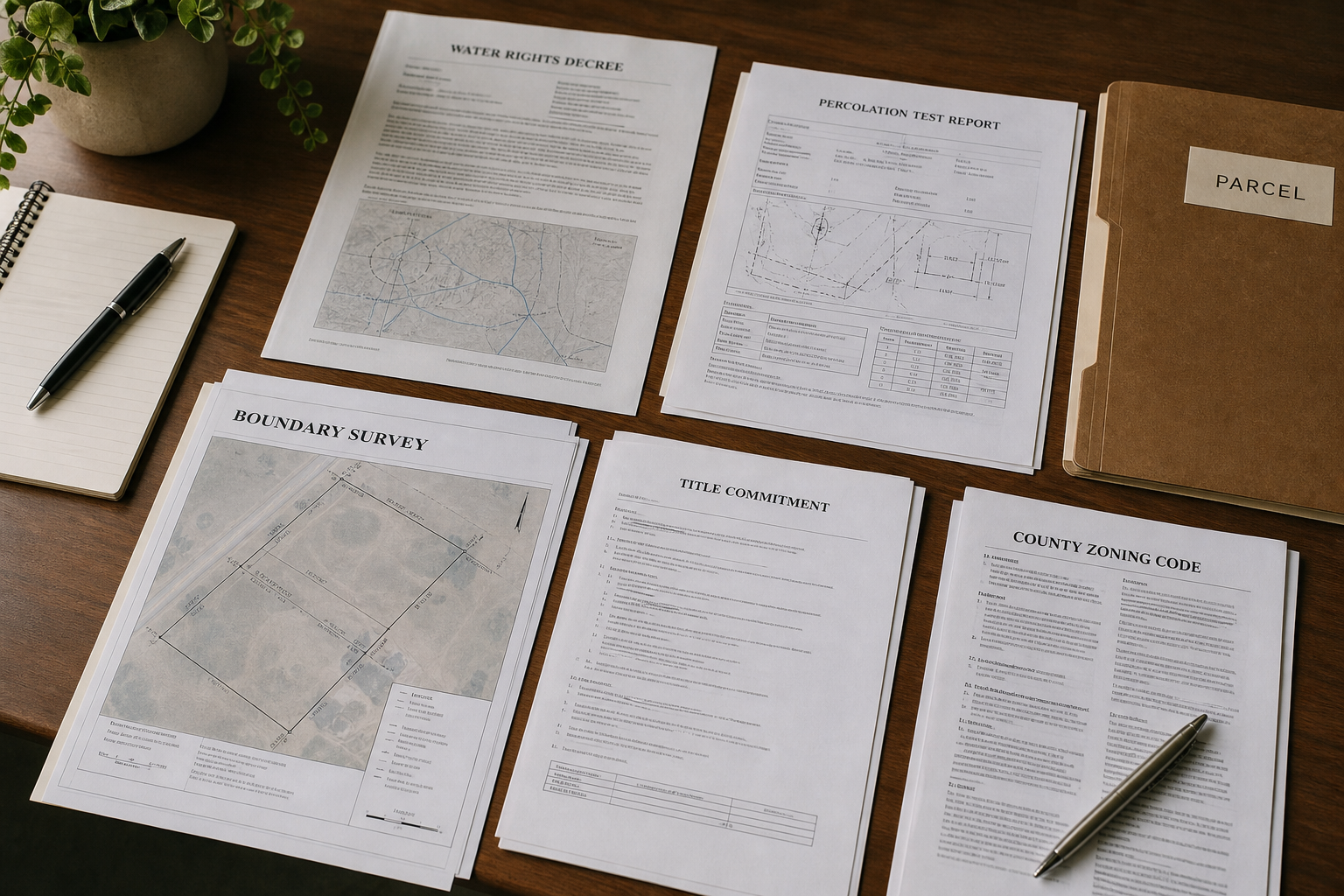
The Six Due-Diligence Inspections That Decide Whether You Close
Every parcel needs all six of the checks below before earnest money goes hard. None of them is optional; they are not ranked in importance because their absence each carries a different category of risk.
| Check | Typical Cost | Timeline | What It Catches | Colorado-Specific Note |
|---|---|---|---|---|
| Title Search & Insurance | $300–$800 | 5–7 days | Liens, easements, recorded encumbrances | Standard policies exclude mineral rights — add an enhanced rider |
| Professional Survey (ALTA / boundary) | $1,500–$5,000 | 2–3 weeks | Boundary disputes, encroachments, easements | Mountain GPS survey runs $85–$125/hr per state board data |
| Mineral Rights Verification | $400–$1,200 (attorney) | ~1 week | Severed subsurface ownership, active leases | Severance is legal and common in Colorado |
| Phase I Environmental Site Assessment | $1,200–$2,500 | 1–2 weeks | Contamination, abandoned tanks, mining residue | Critical near Leadville and Cripple Creek corridors |
| Wildfire Hazard Assessment | $150–$500 | 3–5 days | Insurance availability and premium tier | Cross-reference CSFS Wildfire Risk Viewer |
| Floodplain / FEMA Verification | $0–$300 | 3–5 days | FEMA flood zones, arroyo flash-flood paths | Arid-region flash flood risk exists outside FEMA zones |
Each line of that table earns its cost for a different reason. Mineral rights carry the highest surprise factor. Writing in the Colorado Bar Journal, attorney Michael Rodriguez observes that owning surface but not subsurface means an oil and gas operator can drill with minimal compensation to the surface owner. The mineral rights rider on title insurance typically adds $200 to $500 — cheaper than the litigation it prevents, and the only protection most surface owners will ever have against a severed-estate operator who decides to develop.
In Colorado, what sits above the surface and what lies beneath are legally separate properties. Verifying only one of them and calling it due diligence is how buyers fund someone else's drilling operation.
Wildfire risk has moved from "consideration" to "deal-driver" since 2020. Insurers have non-renewed thousands of Colorado mountain policies. Some parcels in the wildland-urban interface are now effectively uninsurable, which means uncloseable for any financed buyer. Run the parcel through the Colorado State Forest Service Wildfire Risk Viewer before you write an offer, and call two insurance carriers to confirm coverage availability and approximate premium tier. A 4x premium on hazard insurance changes the cap rate on a build project meaningfully.
Surveys matter more in Colorado than in jurisdictions with regular section grids because mountainous topography and old metes-and-bounds descriptions produce frequent boundary errors. The Colorado State Board of Licensure regulates surveyor credentials; verify your surveyor is licensed in Colorado specifically, not just in a neighboring state. As Sarah Chen, P.E., a civil engineer at the Colorado School of Mines who specializes in rural infrastructure, has noted: buyers consistently underestimate how Colorado topography drives infrastructure cost — and survey cost is the first place that shows up. Phase I ESA is overkill for pristine rangeland but essential within 5 miles of historic mining districts, where tailings can contaminate soil and groundwater decades after operations cease. All six checks together total roughly $4,000 to $10,000 — about 1–3% of a typical Colorado land purchase, and the only insurance against discovering a structural problem after closing. The same disciplined due-diligence framework we apply to residential transactions scales up — with Colorado-specific additions — for land purchases.
Contingency Language That Actually Protects a Land Buyer
Two Colorado-specific realities frame this section. First, Colorado uses the Colorado Real Estate Commission's standard Contract to Buy and Sell Real Estate (Land) form; custom contingencies are added as additional provisions or addenda. Second, earnest money is typically 1–3% of purchase price and is forfeited if the buyer terminates outside a written contingency. Vague contingency language is the same as no contingency at all. Below are six contingencies with sample language and the reasoning behind each.
Zoning and Permitted Use Contingency
Buyer's obligation to close is contingent upon Buyer's verification, at Buyer's expense, that the Property's zoning permits [INTENDED USE — e.g., single-family residence with detached ADU and short-term rental] by-right. Buyer shall have until [DATE — typically 30 days] to deliver written notice of objection. If unresolved, Buyer may terminate and receive return of earnest money.
This clause lets you walk if the planning department's written interpretation differs from the listing. Specify the intended use precisely — "residential" is too broad to protect against an STR ban or an ADU restriction. The 30-day window aligns with the timeline most planners need to deliver a written use determination.
Water Rights Verification Contingency
Contingent on Buyer's verification through the Colorado Division of Water Resources of the priority date, decreed amount, point of diversion, and permitted use of any water rights conveyed. Buyer shall have [30–45 days] to confirm. Unsatisfactory results allow termination with full return of earnest money.
CDWR verification takes 14–21 business days; attorney review adds another week. A 30-day window is the absolute minimum, and 45 days is safer if the decree history is complex or includes augmentation plans. The four named elements — priority, amount, point, use — are the elements an attorney will actually verify.
Septic Feasibility (Perc Test) Contingency
Contingent on a satisfactory soil percolation test conducted by a Colorado-licensed installer, demonstrating that the Property supports a conventional on-site wastewater treatment system at a cost not to exceed $[CAP]. Buyer shall have [21 days] to complete.
The cost cap is the critical clause. Without a dollar ceiling, "satisfactory" is subjective and a seller can argue that a $38,000 mound system satisfied the test even when you priced your project assuming a conventional system at half that cost.
Survey and Boundary Contingency
Contingent on an ALTA/NSPS Land Title Survey acceptable to Buyer in Buyer's sole discretion, including verification of acreage, boundary lines, and absence of encroachments. Buyer shall have [30 days] to review and object.
"Sole discretion" is the strongest possible language in a buyer-side contingency. It places the determination entirely in your hands and is difficult to challenge.
Mineral Rights Disclosure Contingency
Seller represents that Seller owns 100% of the mineral rights appurtenant to the Property. If Seller does not own all mineral rights, Seller shall disclose all known prior reservations, leases, and active operations. Buyer may terminate or negotiate a purchase price reduction if any mineral rights are severed.
This surfaces the severance issue before closing and tees up a price negotiation. Severed mineral rights are not always disqualifying — but the price needs to reflect the risk.
Utility and Access Feasibility Contingency
Contingent on Buyer obtaining written cost estimates for electric service extension, year-round legal access, and high-speed internet feasibility. Buyer shall have [30 days] to obtain estimates. Total infrastructure cost exceeding $[CAP] permits termination.
This is where the $30,000-plus underestimate problem documented by the University of Denver Housing Policy Center gets eliminated. The cap turns a soft expectation into a hard deal term.
Three procedural notes specific to Colorado close this section. The Colorado Residential Property Condition Disclosure Act primarily covers residential structures, not raw land — sellers of vacant parcels often have minimal mandated disclosures, which makes contingencies (not disclosures) your protection. Cash offers are common and competitive in mountain markets, but waiving contingencies on a Colorado land purchase is rarely advisable regardless of price pressure. The same disciplined approach used when selling a residential property applies in reverse here: every term you give up has a price, and that price should be calculated, not assumed. Most contingency periods can run concurrently; structure your timeline so all six conclude within 45 days to keep sellers engaged.
The 45-Day Colorado Land Purchase Workflow: Week-by-Week Verification Map
Run this workflow from the moment your offer is accepted. Each week ends in a go/no-go decision. The infographic below maps the sequence; the checklist that follows is what you execute.

Week 1 — Jurisdiction and Zoning Verification
- Confirm jurisdiction via the DOLA county lookup
- Pull the zoning designation from the county GIS portal; screenshot the parcel page with URL and date
- Download the zoning code chapter for that designation
- Call the county planning department; document the planner's name and three answers (use permitted? minimum lot? pending amendments?)
- Toggle all overlay layers in GIS: wildfire, floodplain, ridgeline, historic
- Gate 1: Does zoning permit your intended use by-right? If conditional only, estimate the conditional-use permit timeline (often 90–180 days). If not permitted — terminate under the zoning contingency.
Week 2 — Water Rights and Well Permits
- Search the CDWR water rights database for any decrees tied to the parcel
- Search the CDWR well permit database for existing well permits
- Engage a water rights attorney for decree review ($1,500–$4,000)
- If parcel is under 35 acres or in a designated groundwater basin, get an augmentation cost quote
- Gate 2: Are water rights sufficient and reliable for your intended use? If junior decree with curtailment history — renegotiate price or terminate.
Week 3 — Septic, Survey, and Utilities
- Schedule a perc test with a Colorado-licensed OWTS installer ($800–$1,200)
- Engage a Colorado-licensed land surveyor for boundary survey
- Request a written line-extension estimate from the local electric cooperative
- Verify legal year-round access (recorded road easement or county road)
- Check carrier coverage maps and confirm internet feasibility (fiber, fixed wireless, or Starlink)
- Gate 3: Is total infrastructure cost within your contingency cap? If not — renegotiate or terminate. Owners who plan to hold the parcel as a rental build should pre-budget ongoing property management costs into the infrastructure cap as well.
Week 4 — Title, Mineral Rights, and Environmental
- Order title commitment from a Colorado title company
- Request the mineral rights rider on title insurance
- Pull chain of title from the county clerk; identify any severance language
- Run the parcel through the Colorado State Forest Service Wildfire Risk Viewer and FEMA flood maps
- Order Phase I ESA if parcel is within 5 miles of historic mining or industrial sites
- Gate 4: Are mineral rights intact, insurance available, and environmental clean? If not — adjust price or terminate.
Week 5 — Document Review and Final Negotiation
- Compile all contingency results into one PDF for your agent and attorney
- Identify any items requiring price adjustment (failed perc, junior water right, severed minerals)
- Submit objection notice or amendment request before contingency deadlines expire
- Lock in financing if applicable; confirm appraiser has rural land experience
- Investors evaluating duplex or multi-unit purchases run a parallel version of this workflow — see our duplex investment guide for the income-property equivalent
- Gate 5: All material issues resolved in writing? If not — extend or terminate.
Week 6 — Closing Preparation
- Order updated title commitment 10 days before closing
- Confirm survey is recorded and delivered to title
- Wire earnest money balance and closing funds per title's wire instructions (verify by phone)
- Walk the parcel one final time; photograph boundary markers, access points, and any new conditions
- Review final closing disclosure for accuracy on legal description, water rights conveyed, and mineral rights
- Gate 6: Final closing disclosure matches contract and contingency outcomes? Close.
Keep every email, every planner conversation memo, and every contractor estimate in a single folder labeled with the parcel ID. After closing, that folder becomes your permitting and insurance reference for the next decade. Buyers who treat the file as disposable end up re-doing surveys and perc tests they already paid for. Whether the next file in your folder is a Colorado parcel or a Florida residence, the discipline of running every land for sale colorado opportunity through the same six gates is what separates the buyers who build from the buyers who litigate.